


Explore our most common drone data deliverables below.
We offer a plentitude of drone data options from raw data to a wide range of sensors/payloads - from RGB/Optical to LiDAR, Multispectral, Thermal sensors and more. All to make sure you are able to understand the world and take action. Read more about our data deliverables below.
Introduction
We always provide our data quickly, safely, and adapted to your needs. Regardless of what you’re after.
More information
With thousands of operators, loads of data, and many years of experience – you get the exact type of data you need, when you need it. Regardless if it’s predicting a disaster or inspecting a telecom tower. Read about our different data products and see for yourself.
Available Data products
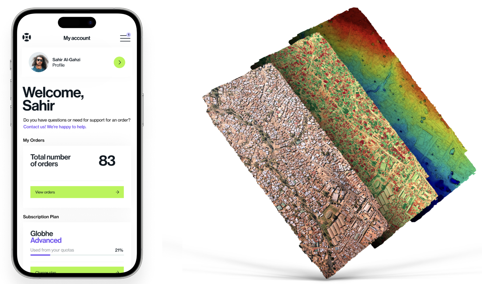
Thermal Imagery, Orthomosaic 2D maps, Digital Twins (3D maps and Point Clouds), Digital Terrain Models, DTM, Digital Surface Models, DSM, Topographic maps, Source Data/Raw-data, Plant Health maps.
Data products

Raw Data
Unprocessed images and/or footage can be requested for clients using their proprietary processing software.
Orthomosaic 2D maps
The single images captured by the drones are stitched together into a single large high-quality 2D orthomosaic map. Having a 2D map can be utilized across a range of industries, including construction and infrastructure, and used in all modeling and GIS software. Based on the capturing configuration, the resolution is up to a few mm/px. Zoom in and rotate this map to see the high-resolution images and the big difference they can make when compared to satellites.


3D maps and Point Clouds
Similar to orthomosaic maps, drone images are stitched together and create a high-resolution 3D model represented by a 3D mesh surface or a point cloud. The latter is a 3D visualization of thousands or even millions of georeferenced points. Point clouds provide high-resolution data and give you an interactive 3D model with real-world imagery and easy modification in 3D modeling software. Point clouds can also be used to develop digitized models of structures for CAD and BIM-related purposes, which is at the forefront of modern construction.
Digital Terrain Models
The terrain surface map reveals the ground surface without any objects represented. It allows detailed terrain analysis, planning construction, hydrological applications, and modeling environmental risks. The resolution of these DEMs can reach up to a few cm according to the drone configuration. Zoom in and rotate this map to see the high-resolution model we can provide.


Digital Surface Models
Represents elevation data captured by a drone, including all the surfaces it sees, such as trees, equipment, and other structures. It is different than the digital terrain model as it shows objects and vegetation. This model is ideal for the agricultural industry and other industries, as it allows for vegetation inspection and management. Depending on the mission configuration, the resolution can be down to 1 cm. The data can also create accurate volumetric calculations from these elevation maps.
Topographic maps
Topographic maps conventionally show the topography utilizing contour lines. The latter are curves connecting points of equal elevation above a given level, such as the mean sea level. The contour interval of a contour map is the difference in elevation between successive contour lines. High-resolution topographic maps are very useful when investigating natural hazard assessment, slope stability, large construction projects, hydrogeology, and monitoring of underground resources. In addition, differentiated topography resulting from surface motion is critical in understanding tectonic and volcanic activities and their resulting hazards. Resolution can reach less than 1 cm depending on the mission configuration.

Multispectral data
Multispectral data is a game-changer in the realm of drone data. By capturing images across different electromagnetic spectrum bands, this data unlocks crucial insights beyond human perception. Its applications span precision agriculture, environmental monitoring, forestry management, and land-use planning. Analyzing multispectral data empowers decision-makers with valuable information on vegetation health, soil composition, water quality, and more, driving informed choices and resource optimization. Discover the transformative potential of multispectral data for your industry.

.webp)
Plant health/NDVI maps
Plant health maps explore agricultural data even more deeply by visualizing variability within a field to quantify damage and predict yields by showing the area within a specific range. Uses a multi-spectral camera or NDVI algorithm to extract plant health information from RGB images.
Thermal imagery
Survey with a thermal camera and quickly identify targets with abnormal heat signatures.
Thermal surveys can help identify heat loss to improve energy efficiency; can locate water leaks or moisture ingress or faults with wiring and other electrical components. They are also very beneficial in forestry as they help identify early fire risks before they develop and spread.

